Determining Acquisition Dates in Esri’s World Imagery Basemap
For Geographic Information System (GIS) professionals, the temporal accuracy of data is as critical as its spatial accuracy. When utilizing composite basemaps such as Esri’s World Imagery service, a common challenge is determining the acquisition date of the underlying imagery. This metadata is essential for a wide range of applications, from change detection analysis to environmental monitoring and historical review.
To address this need, a specialized web application, the Esri Imagery Date Finder, provides a direct and efficient solution for querying and displaying this vital temporal information.
The Esri Imagery Date Finder: A Utility for Data Provenance
The Esri Imagery Date Finder is a lightweight, browser-based tool designed for a singular purpose: to reveal the acquisition date of individual tiles within the Esri World Imagery basemap. By interfacing with the imagery service’s metadata, the application eliminates ambiguity regarding data vintage, thereby enhancing the integrity of any analysis built upon it.
Operational Workflow
The application is designed for ease of use, allowing professionals to quickly integrate it into their data validation workflows.
- Access the Application: Navigate to the Esri Imagery Date Finder portal.
- Define Area of Interest (AOI): Pan and zoom to your specific geographic location.
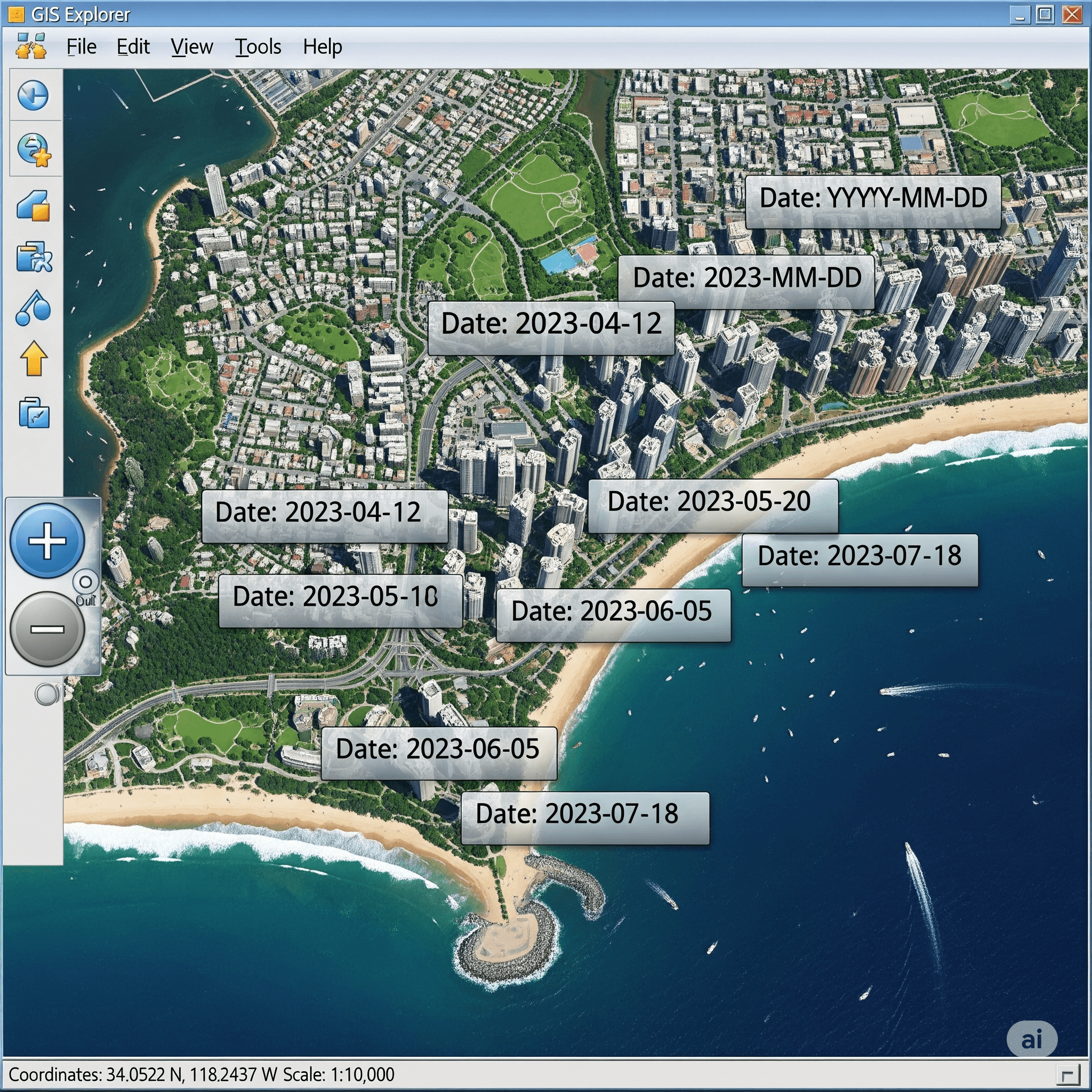
- Engage the Service: The date-finding functionality is automatically triggered when the map scale reaches zoom level 12 or greater. Upon reaching this threshold, the application queries the service and renders the date for each imagery tile visible in the map extent.
- Review Metadata: As you pan across the map at this zoom level, the displayed dates will update dynamically, reflecting the specific metadata for each tile.
Understanding Imagery Data Sources
Esri’s World Imagery basemap is a comprehensive mosaic compiled from numerous high-quality sources. The Date Finder tool provides transparency into this compilation, which includes data from providers such as:
- Esri
- i-cubed
- U.S. Department of Agriculture (USDA)
- U.S. Geological Survey (USGS)
- AEX
- GeoEye
- Getmapping
- Aerogrid
- IGN
- IGP
- UPR-EGP
- Contributions from the global GIS User Community
Knowledge of the specific data source, in conjunction with its acquisition date, provides a more complete understanding of the imagery’s provenance.
Open Source Availability for Developer
The Esri Imagery Date Finder is an open-source project, with its source code available for review and contribution. The “Fork me on GitHub” link directs users to the project’s repository. This allows for community-driven improvements, custom implementations, and provides a valuable resource for developers working with Esri’s web services.
Conclusion
The Esri Imagery Date Finder is a crucial utility for any GIS analyst, researcher, or professional who relies on the Esri World Imagery service for accurate and reliable spatial analysis. By providing on-demand access to essential temporal metadata, this tool supports data validation, improves analytical integrity, and reinforces the principles of thorough data provenance. It is a recommended resource for enhancing the quality and reliability of geospatial work.