
Dijkstra’s algorithm simulation
This post provides an interactive simulation to visualize the algorithm’s execution and an in-depth breakdown of the logic...
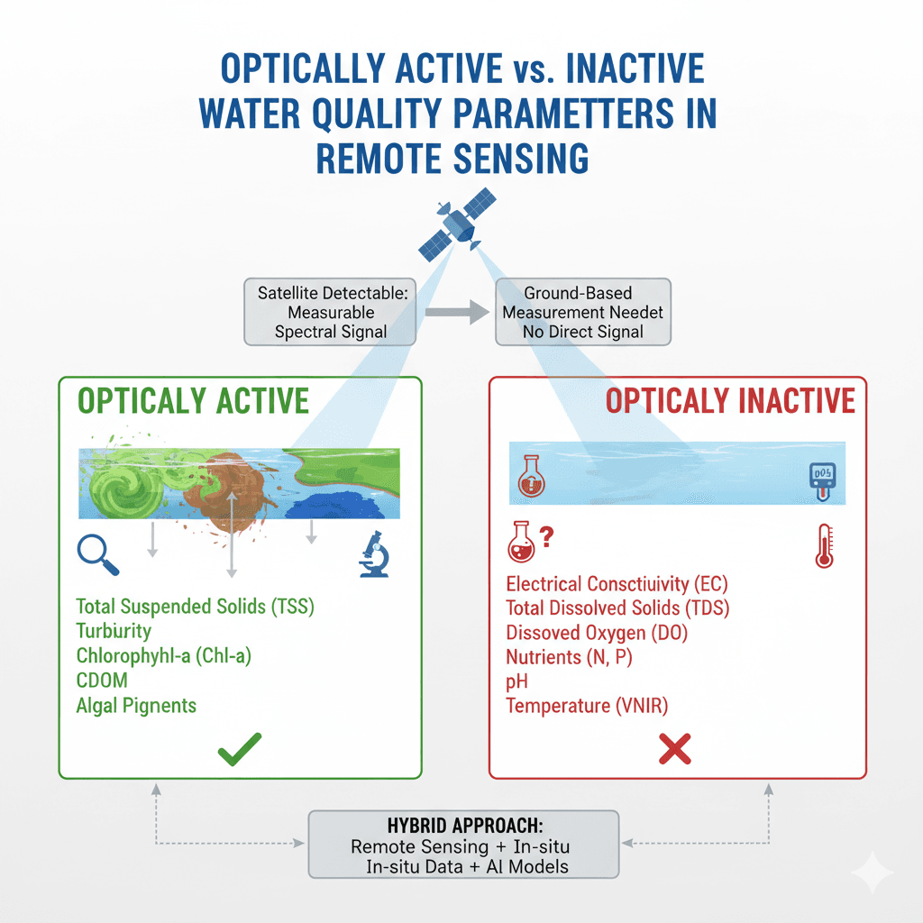
Optically Active vs. Inactive Water Quality Parameters in Remote Sensing
Monitoring the quality of rivers, lakes, and coastal waters has traditionally relied on field sampling and laboratory tests....
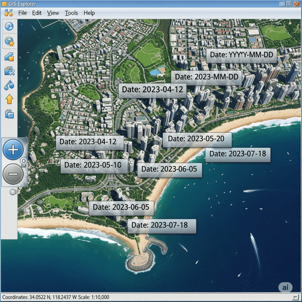
Determining Acquisition Dates in Esri’s World Imagery Basemap
Determining Acquisition Dates in Esri’s World Imagery Basemap For Geographic Information System (GIS) professionals, the temporal accuracy of...

Exploring the Geospatial: Must-Attend Conferences in 2025
If you’re passionate about geospatial technologies, 2025 is shaping up to be an exciting year filled with conferences...

AI for Remote Sensing in Geosciences
Remote sensing, the art of gathering information about the Earth without physically touching it, is undergoing a dramatic transformation thanks to the integration of Artificial Intelligence (AI). This article, based on a comprehensive review adopted from Janga et al 2023 research, explores the exciting intersection of these two fields and its potential to revolutionize Earth sciences.

AI for Earth: The #AIForEarthChallenge2024 is Here!
The world is facing a climate crisis, and Earth observation is playing a critical role in understanding and...

Field Area Segmentation: Competition
Segmenting Field Regions from Satellite Images With the advent of satellite technology, we have gained a bird’s-eye view...

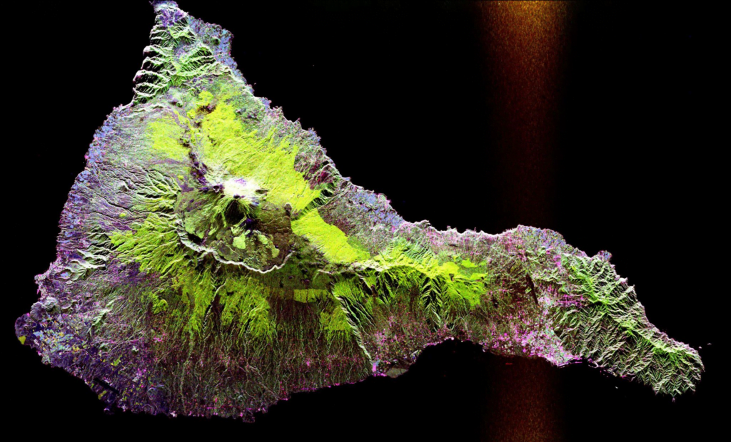
Microwave remote sensing
Microwave sensing encompasses two types of remote sensing: active and passive. Microwaves cover wavelengths ranging from approximately 1cm...

Top geospatial tools in Python
Collection of top geospatial tools in Python Geospatial data analysis has become increasingly important in today’s world with the...